The Latest
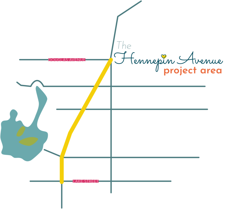
On December 7, 2021 the Minneapolis Public Works Department released their recommended layout for the Hennepin Avenue South reconstruction project from Lake Street to Douglas Avenue (construction is set to begin in 2024 and finish in 2026). We’re beyond thrilled to see the inclusion of 24/7 bus lanes, a sidewalk level bike path, and pedestrian improvements. We’ve spent many months organizing for this inclusive design. In the recommended layout we see priority for people, advancement of racial justice, and consideration of the climate crisis.
To support the recommended layout it’s important to submit a comment before January 28, 2022.

History of the Process
The Hennepin Avenue process kicked off back in 2018. Construction was originally set to begin in 2023, but the City delayed the start time by a year after listening to the concerns of local businesses and their struggles during the pandemic. Allowing them a chance to recover before construction would begin. As of now, Hennepin Avenue is scheduled to be reconstructed in 2024 with completion in 2026. It will be another 50 years before the street is reconstructed again. This is a once-in-a-lifetime opportunity and essential that we get the design right.
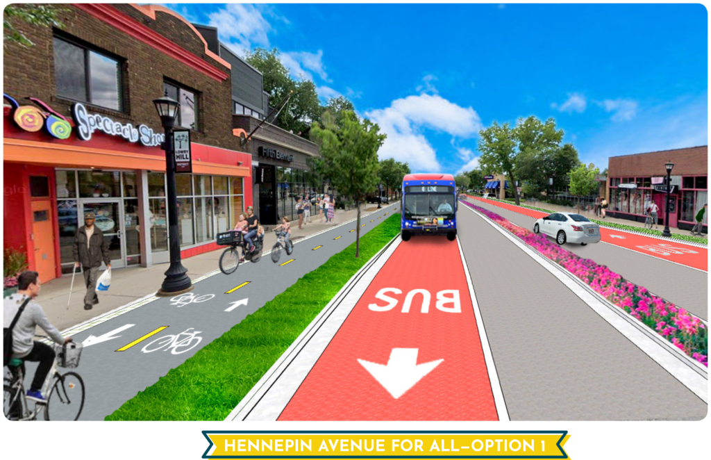
On March 2, 2021 the City of Minneapolis presented us with two options for the Hennepin Avenue reconstruction project from Lake Street to Douglas Avenue. Unfortunately, Option 2 does not meet the real needs of a street like Hennepin Avenue. It would not include any way for people to safely bike to and between the homes, parks, schools, and businesses along Hennepin Avenue. This would be replicating the current design problems of the street. People either bike on the sidewalks (encroaching on those walking and using wheelchairs) or in the street with buses and trucks (risking themselves). Some people feel so unsafe they avoid the street altogether, weakening our local businesses, or they drive instead, causing congestion and worsening air and noise pollution.
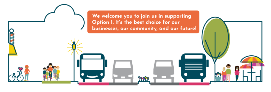
Option 1 best aligns with the vision we share for this important corridor, lined with hundreds of homes and dozens of businesses, ferrying thousands of people each day by foot, wheelchair, scooter, bike, skateboard, bus, and car. Option 1 creates one of the best main streets in our region, a pleasant, safe, and vibrant place for our community. It welcomes and is safe for everyone, no matter how we travel. For the sake of the corridor’s long-term vitality, Option 1 is the choice for our community and local businesses.
Update (12/10/2021): The city’s Public Works department has recommended an enhanced Option 1. Now we need the City Council and Mayor to support this decision.